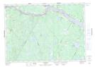
Maps showing Ellegood Rips, York, New Brunswick
Ellegood Rips is a Rapids located in York, New Brunswick and has an elevation of 131 meters.
- Latitude: 45° 54' 7'' North (decimal: 45.9018658)
- Longitude: 67° 9' 29'' West (decimal: -67.1579422)
- Topography Feature Category: Rapids
- Geographical Feature: Rips
- Canadian Province/Territory: New Brunswick
- Elevation: 131 meters
- Location: York
- Atlas of Canada Locator Map: Ellegood Rips
- GPS Coordinate Locator Map: Ellegood Rips Lat/Long
Ellegood Rips NTS Map Sheets