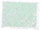
Maps showing Gilchrist Cove, Queens, New Brunswick
Gilchrist Cove is a Bay located in Queens, New Brunswick and has an elevation of 18 meters.
- Latitude: 45° 46' 47'' North (decimal: 45.7797554)
- Longitude: 66° 0' 13'' West (decimal: -66.003732)
- Topography Feature Category: Bay
- Geographical Feature: Cove
- Canadian Province/Territory: New Brunswick
- Elevation: 18 meters
- Location: Queens
- Atlas of Canada Locator Map: Gilchrist Cove
- GPS Coordinate Locator Map: Gilchrist Cove Lat/Long
Gilchrist Cove NTS Map Sheets