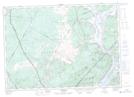
Maps showing Motts Wharf, Queens, New Brunswick
Motts Wharf is a Marine navigation feature located in Queens, New Brunswick and has an elevation of 23 meters.
- Latitude: 45° 44' 28'' North (decimal: 45.7410981)
- Longitude: 66° 1' 16'' West (decimal: -66.0210099)
- Topography Feature Category: Marine navigation feature
- Geographical Feature: Wharf
- Canadian Province/Territory: New Brunswick
- Elevation: 23 meters
- Location: Queens
- Atlas of Canada Locator Map: Motts Wharf
- GPS Coordinate Locator Map: Motts Wharf Lat/Long
Motts Wharf NTS Map Sheets