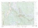
Maps showing Nan Island, York, New Brunswick
Nan Island is a Island located in York, New Brunswick and has an elevation of 119 meters.
- Latitude: 45° 41' 29'' North (decimal: 45.6913636)
- Longitude: 67° 47' 32'' West (decimal: -67.7923311)
- Topography Feature Category: Island
- Geographical Feature: Island
- Canadian Province/Territory: New Brunswick
- Elevation: 119 meters
- Location: York
- Atlas of Canada Locator Map: Nan Island
- GPS Coordinate Locator Map: Nan Island Lat/Long
Nan Island NTS Map Sheets