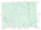
Maps showing Nashwaak Village, York, New Brunswick
Nashwaak Village is a Unincorporated area located in York, New Brunswick and has an elevation of 33 meters.
- Latitude: 46° 5' 44'' North (decimal: 46.0956838)
- Longitude: 66° 36' 42'' West (decimal: -66.6115782)
- Topography Feature Category: Unincorporated area
- Geographical Feature: Dispersed Rural Community
- Canadian Province/Territory: New Brunswick
- Elevation: 33 meters
- Location: York
- Atlas of Canada Locator Map: Nashwaak Village
- GPS Coordinate Locator Map: Nashwaak Village Lat/Long
Nashwaak Village NTS Map Sheets