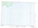
Maps showing Anthonys Brook, Saint John, New Brunswick
Anthonys Brook is a River located in Saint John, New Brunswick and has an elevation of 51 meters.
- Latitude: 45° 13' 46'' North (decimal: 45.2295589)
- Longitude: 65° 59' 33'' West (decimal: -65.9924572)
- Topography Feature Category: River
- Geographical Feature: Brook
- Canadian Province/Territory: New Brunswick
- Elevation: 51 meters
- Location: Saint John
- Atlas of Canada Locator Map: Anthonys Brook
- GPS Coordinate Locator Map: Anthonys Brook Lat/Long
Anthonys Brook NTS Map Sheets