Maps showing St. Andrews Harbour, Charlotte, New Brunswick
St. Andrews Harbour is a Bay located in Charlotte, New Brunswick and has an elevation of 1 meters.
- Latitude: 45° 4' 9'' North (decimal: 45.0691138)
- Longitude: 67° 3' 30'' West (decimal: -67.0583449)
- Topography Feature Category: Bay
- Geographical Feature: Harbour
- Canadian Province/Territory: New Brunswick
- Elevation: 1 meters
- Location: Charlotte
- Atlas of Canada Locator Map: St. Andrews Harbour
- GPS Coordinate Locator Map: St. Andrews Harbour Lat/Long
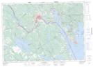
St. Andrews Harbour NTS Map Sheets