Maps showing Rivière Saint-Jean, Saint John, New Brunswick
Rivière Saint-Jean is a River located in Saint John, New Brunswick and has an elevation of 28 meters.
- Latitude: 45° 16' North (decimal: 45.2667000)
- Longitude: 66° 4' West (decimal: -66.0666999)
- Topography Feature Category: River
- Geographical Feature: Rivière
- Canadian Province/Territory: New Brunswick
- Elevation: 28 meters
- Location: Saint John
- Atlas of Canada Locator Map: Rivière Saint-Jean
- GPS Coordinate Locator Map: Rivière Saint-Jean Lat/Long
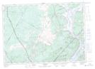
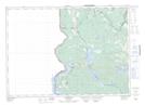
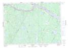
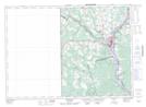
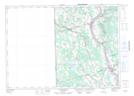
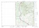
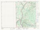
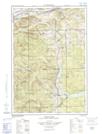
Rivière Saint-Jean NTS Map Sheets
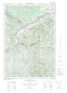
021G08 Saint John Topographic Map at 1:50,000 scale
021G09 Hampstead Topographic Map at 1:50,000 scale
021G13 Fosterville Topographic Map at 1:50,000 scale
021G14 Canterbury Topographic Map at 1:50,000 scale
021G15 Fredericton Topographic Map at 1:50,000 scale
021G16 Grand Lake Topographic Map at 1:50,000 scale
021J03 Millville Topographic Map at 1:50,000 scale
021J04 Woodstock Topographic Map at 1:50,000 scale
021J05 Florenceville Topographic Map at 1:50,000 scale
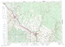
021J12 Perth-Andover Topographic Map at 1:50,000 scale
021J13 Aroostook Topographic Map at 1:50,000 scale
021N02E Connors Topographic Map at 1:50,000 scale
021N02W Connors Topographic Map at 1:50,000 scale
021N07 Lac-Baker Topographic Map at 1:50,000 scale
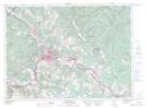
021N08 Edmundston Topographic Map at 1:50,000 scale
021O04 Grand Falls Topographic Map at 1:50,000 scale
021G Fredericton Topographic Map at 1:250,000 scale
021J Woodstock Topographic Map at 1:250,000 scale
021N Edmundston Topographic Map at 1:250,000 scale
021O Campbellton Topographic Map at 1:250,000 scale