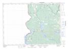
Maps showing Sam Foster Hill, York, New Brunswick
Sam Foster Hill is a Mountain located in York, New Brunswick and has an elevation of 215 meters.
- Latitude: 45° 48' 13'' North (decimal: 45.8036421)
- Longitude: 67° 43' 49'' West (decimal: -67.7303101)
- Topography Feature Category: Mountain
- Geographical Feature: Hill
- Canadian Province/Territory: New Brunswick
- Elevation: 215 meters
- Location: York
- Atlas of Canada Locator Map: Sam Foster Hill
- GPS Coordinate Locator Map: Sam Foster Hill Lat/Long
Sam Foster Hill NTS Map Sheets