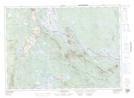
Maps showing Sandy Cove, York, New Brunswick
Sandy Cove is a Bay located in York, New Brunswick and has an elevation of 124 meters.
- Latitude: 45° 37' 32'' North (decimal: 45.6256075)
- Longitude: 67° 34' 27'' West (decimal: -67.5741102)
- Topography Feature Category: Bay
- Geographical Feature: Cove
- Canadian Province/Territory: New Brunswick
- Elevation: 124 meters
- Location: York
- Atlas of Canada Locator Map: Sandy Cove
- GPS Coordinate Locator Map: Sandy Cove Lat/Long
Sandy Cove NTS Map Sheets