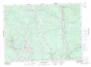
Maps showing Schoolhouse Brook, York, New Brunswick
Schoolhouse Brook is a River located in York, New Brunswick and has an elevation of 73 meters.
- Latitude: 46° 13' 37'' North (decimal: 46.2269281)
- Longitude: 66° 36' 59'' West (decimal: -66.6163413)
- Topography Feature Category: River
- Geographical Feature: Brook
- Canadian Province/Territory: New Brunswick
- Elevation: 73 meters
- Location: York
- Atlas of Canada Locator Map: Schoolhouse Brook
- GPS Coordinate Locator Map: Schoolhouse Brook Lat/Long
Schoolhouse Brook NTS Map Sheets