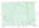
Maps showing Seymour Meadows, York, New Brunswick
Seymour Meadows is a Low vegetation located in York, New Brunswick and has an elevation of 100 meters.
- Latitude: 46° 2' 41'' North (decimal: 46.0446669)
- Longitude: 66° 39' 7'' West (decimal: -66.6518569)
- Topography Feature Category: Low vegetation
- Geographical Feature: Meadows
- Canadian Province/Territory: New Brunswick
- Elevation: 100 meters
- Location: York
- Atlas of Canada Locator Map: Seymour Meadows
- GPS Coordinate Locator Map: Seymour Meadows Lat/Long
Seymour Meadows NTS Map Sheets