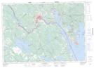
Maps showing Gallop Stream, Charlotte, New Brunswick
Gallop Stream is a River located in Charlotte, New Brunswick and has an elevation of 36 meters.
- Latitude: 45° 14' 16'' North (decimal: 45.2377955)
- Longitude: 67° 11' 25'' West (decimal: -67.1903212)
- Topography Feature Category: River
- Geographical Feature: Stream
- Canadian Province/Territory: New Brunswick
- Elevation: 36 meters
- Location: Charlotte
- Atlas of Canada Locator Map: Gallop Stream
- GPS Coordinate Locator Map: Gallop Stream Lat/Long
Gallop Stream NTS Map Sheets