Maps showing Beulah, Kings, New Brunswick
Beulah is a Unincorporated area located in Kings, New Brunswick and has an elevation of 63 meters.
- Latitude: 45° 37' 6'' North (decimal: 45.6182470)
- Longitude: 66° 0' 29'' West (decimal: -66.0081337)
- Topography Feature Category: Unincorporated area
- Geographical Feature: Dispersed Rural Community
- Canadian Province/Territory: New Brunswick
- Elevation: 63 meters
- Location: Kings
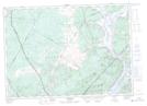
- Atlas of Canada Locator Map: Beulah
- GPS Coordinate Locator Map: Beulah Lat/Long
Beulah NTS Map Sheets