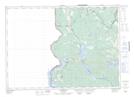
Maps showing Club Island, York, New Brunswick
Club Island is a Island located in York, New Brunswick and has an elevation of 202 meters.
- Latitude: 45° 49' 13'' North (decimal: 45.8202024)
- Longitude: 67° 32' 18'' West (decimal: -67.5382294)
- Topography Feature Category: Island
- Geographical Feature: Island
- Canadian Province/Territory: New Brunswick
- Elevation: 202 meters
- Location: York
- Atlas of Canada Locator Map: Club Island
- GPS Coordinate Locator Map: Club Island Lat/Long
Club Island NTS Map Sheets