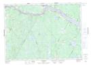
Maps showing Collicott Pond, York, New Brunswick
Collicott Pond is a Lake located in York, New Brunswick and has an elevation of 149 meters.
- Latitude: 45° 52' 28'' North (decimal: 45.874573)
- Longitude: 67° 20' 37'' West (decimal: -67.3434951)
- Topography Feature Category: Lake
- Geographical Feature: Pond
- Canadian Province/Territory: New Brunswick
- Elevation: 149 meters
- Location: York
- Atlas of Canada Locator Map: Collicott Pond
- GPS Coordinate Locator Map: Collicott Pond Lat/Long
Collicott Pond NTS Map Sheets