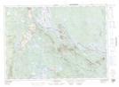
Maps showing Silas Cove, York, New Brunswick
Silas Cove is a Bay located in York, New Brunswick and has an elevation of 110 meters.
- Latitude: 45° 39' 26'' North (decimal: 45.6572241)
- Longitude: 67° 30' 17'' West (decimal: -67.5048301)
- Topography Feature Category: Bay
- Geographical Feature: Cove
- Canadian Province/Territory: New Brunswick
- Elevation: 110 meters
- Location: York
- Atlas of Canada Locator Map: Silas Cove
- GPS Coordinate Locator Map: Silas Cove Lat/Long
Silas Cove NTS Map Sheets