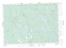
Maps showing Smith Lake, Charlotte, New Brunswick
Smith Lake is a Lake located in Charlotte, New Brunswick and has an elevation of 130 meters.
- Latitude: 45° 15' 10'' North (decimal: 45.2528438)
- Longitude: 66° 29' 57'' West (decimal: -66.4993022)
- Topography Feature Category: Lake
- Geographical Feature: Lake
- Canadian Province/Territory: New Brunswick
- Elevation: 130 meters
- Location: Charlotte
- Atlas of Canada Locator Map: Smith Lake
- GPS Coordinate Locator Map: Smith Lake Lat/Long
Smith Lake NTS Map Sheets