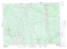
Maps showing Covered Bridge, York, New Brunswick
Covered Bridge is a Unincorporated area located in York, New Brunswick and has an elevation of 69 meters.
- Latitude: 46° 14' 36'' North (decimal: 46.2432545)
- Longitude: 66° 36' 57'' West (decimal: -66.6159063)
- Topography Feature Category: Unincorporated area
- Geographical Feature: Railway Point
- Canadian Province/Territory: New Brunswick
- Elevation: 69 meters
- Location: York
- Atlas of Canada Locator Map: Covered Bridge
- GPS Coordinate Locator Map: Covered Bridge Lat/Long
Covered Bridge NTS Map Sheets