Maps showing Coxs Islands, Charlotte, New Brunswick
Coxs Islands is a Island located in Charlotte, New Brunswick and has an elevation of 35 meters.
- Latitude: 45° 17' 55'' North (decimal: 45.2987253)
- Longitude: 66° 49' 51'' West (decimal: -66.8306987)
- Topography Feature Category: Island
- Geographical Feature: Islands
- Canadian Province/Territory: New Brunswick
- Elevation: 35 meters
- Location: Charlotte
- Atlas of Canada Locator Map: Coxs Islands
- GPS Coordinate Locator Map: Coxs Islands Lat/Long
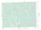
Coxs Islands NTS Map Sheets