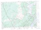
Maps showing Crafts Cove, Queens, New Brunswick
Crafts Cove is a Unincorporated area located in Queens, New Brunswick and has an elevation of 39 meters.
- Latitude: 45° 44' 0'' North (decimal: 45.7333812)
- Longitude: 66° 0' 7'' West (decimal: -66.0019863)
- Topography Feature Category: Unincorporated area
- Geographical Feature: Dispersed Rural Community
- Canadian Province/Territory: New Brunswick
- Elevation: 39 meters
- Location: Queens
- Atlas of Canada Locator Map: Crafts Cove
- GPS Coordinate Locator Map: Crafts Cove Lat/Long
Crafts Cove NTS Map Sheets