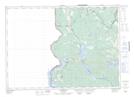
Maps showing Spruce Point, York, New Brunswick
Spruce Point is a Cape located in York, New Brunswick and has an elevation of 130 meters.
- Latitude: 45° 46' 15'' North (decimal: 45.7709553)
- Longitude: 67° 48' 5'' West (decimal: -67.8014823)
- Topography Feature Category: Cape
- Geographical Feature: Point
- Canadian Province/Territory: New Brunswick
- Elevation: 130 meters
- Location: York
- Atlas of Canada Locator Map: Spruce Point
- GPS Coordinate Locator Map: Spruce Point Lat/Long
Spruce Point NTS Map Sheets