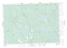
Maps showing Stevenson Hill, Charlotte, New Brunswick
Stevenson Hill is a Mountain located in Charlotte, New Brunswick and has an elevation of 94 meters.
- Latitude: 45° 17' 11'' North (decimal: 45.2862521)
- Longitude: 67° 0' 37'' West (decimal: -67.0102454)
- Topography Feature Category: Mountain
- Geographical Feature: Hill
- Canadian Province/Territory: New Brunswick
- Elevation: 94 meters
- Location: Charlotte
- Atlas of Canada Locator Map: Stevenson Hill
- GPS Coordinate Locator Map: Stevenson Hill Lat/Long
Stevenson Hill NTS Map Sheets