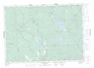
Maps showing Diamond Pools, Charlotte, New Brunswick
Diamond Pools is a River feature located in Charlotte, New Brunswick and has an elevation of 109 meters.
- Latitude: 45° 18' 19'' North (decimal: 45.3051882)
- Longitude: 66° 31' 15'' West (decimal: -66.5207774)
- Topography Feature Category: River feature
- Geographical Feature: Pools
- Canadian Province/Territory: New Brunswick
- Elevation: 109 meters
- Location: Charlotte
- Atlas of Canada Locator Map: Diamond Pools
- GPS Coordinate Locator Map: Diamond Pools Lat/Long
Diamond Pools NTS Map Sheets