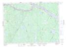
Maps showing Doherty Pond, York, New Brunswick
Doherty Pond is a Lake located in York, New Brunswick and has an elevation of 129 meters.
- Latitude: 45° 55' 2'' North (decimal: 45.9172075)
- Longitude: 67° 21' 3'' West (decimal: -67.3508665)
- Topography Feature Category: Lake
- Geographical Feature: Pond
- Canadian Province/Territory: New Brunswick
- Elevation: 129 meters
- Location: York
- Atlas of Canada Locator Map: Doherty Pond
- GPS Coordinate Locator Map: Doherty Pond Lat/Long
Doherty Pond NTS Map Sheets