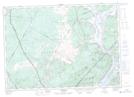
Maps showing Howe Brook, Queens, New Brunswick
Howe Brook is a River located in Queens, New Brunswick and has an elevation of 120 meters.
- Latitude: 45° 34' 27'' North (decimal: 45.5741481)
- Longitude: 66° 13' 41'' West (decimal: -66.2280187)
- Topography Feature Category: River
- Geographical Feature: Brook
- Canadian Province/Territory: New Brunswick
- Elevation: 120 meters
- Location: Queens
- Atlas of Canada Locator Map: Howe Brook
- GPS Coordinate Locator Map: Howe Brook Lat/Long
Howe Brook NTS Map Sheets