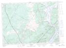
Maps showing Inchby Ridge, Queens, New Brunswick
Inchby Ridge is a Mountain located in Queens, New Brunswick and has an elevation of 182 meters.
- Latitude: 45° 35' 27'' North (decimal: 45.5909304)
- Longitude: 66° 12' 16'' West (decimal: -66.2045636)
- Topography Feature Category: Mountain
- Geographical Feature: Ridge
- Canadian Province/Territory: New Brunswick
- Elevation: 182 meters
- Location: Queens
- Atlas of Canada Locator Map: Inchby Ridge
- GPS Coordinate Locator Map: Inchby Ridge Lat/Long
Inchby Ridge NTS Map Sheets