Maps showing Jimmy Hill, Charlotte, New Brunswick
Jimmy Hill is a Mountain located in Charlotte, New Brunswick and has an elevation of 193 meters.
- Latitude: 45° 26' 4'' North (decimal: 45.4345725)
- Longitude: 66° 37' 53'' West (decimal: -66.6313055)
- Topography Feature Category: Mountain
- Geographical Feature: Hill
- Canadian Province/Territory: New Brunswick
- Elevation: 193 meters
- Location: Charlotte
- Atlas of Canada Locator Map: Jimmy Hill
- GPS Coordinate Locator Map: Jimmy Hill Lat/Long
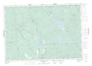
Jimmy Hill NTS Map Sheets