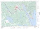
Maps showing Joes Point, Charlotte, New Brunswick
Joes Point is a Cape located in Charlotte, New Brunswick and has an elevation of 12 meters.
- Latitude: 45° 4' 35'' North (decimal: 45.0764518)
- Longitude: 67° 4' 57'' West (decimal: -67.0824006)
- Topography Feature Category: Cape
- Geographical Feature: Point
- Canadian Province/Territory: New Brunswick
- Elevation: 12 meters
- Location: Charlotte
- Atlas of Canada Locator Map: Joes Point
- GPS Coordinate Locator Map: Joes Point Lat/Long
Joes Point NTS Map Sheets