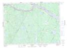
Maps showing Dunham Hill, York, New Brunswick
Dunham Hill is a Mountain located in York, New Brunswick and has an elevation of 220 meters.
- Latitude: 46° 0' 16'' North (decimal: 46.0044328)
- Longitude: 67° 21' 58'' West (decimal: -67.3659834)
- Topography Feature Category: Mountain
- Geographical Feature: Hill
- Canadian Province/Territory: New Brunswick
- Elevation: 220 meters
- Location: York
- Atlas of Canada Locator Map: Dunham Hill
- GPS Coordinate Locator Map: Dunham Hill Lat/Long
Dunham Hill NTS Map Sheets