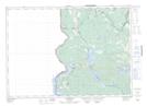
Maps showing Inches Ridge, York, New Brunswick
Inches Ridge is a Mountain located in York, New Brunswick and has an elevation of 166 meters.
- Latitude: 45° 58' 30'' North (decimal: 45.9749263)
- Longitude: 67° 36' 17'' West (decimal: -67.6047613)
- Topography Feature Category: Mountain
- Geographical Feature: Ridge
- Canadian Province/Territory: New Brunswick
- Elevation: 166 meters
- Location: York
- Atlas of Canada Locator Map: Inches Ridge
- GPS Coordinate Locator Map: Inches Ridge Lat/Long
Inches Ridge NTS Map Sheets