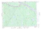
Maps showing Indian Rips, York, New Brunswick
Indian Rips is a Rapids located in York, New Brunswick and has an elevation of 128 meters.
- Latitude: 45° 54' 46'' North (decimal: 45.9129018)
- Longitude: 67° 19' 49'' West (decimal: -67.3301825)
- Topography Feature Category: Rapids
- Geographical Feature: Rips
- Canadian Province/Territory: New Brunswick
- Elevation: 128 meters
- Location: York
- Atlas of Canada Locator Map: Indian Rips
- GPS Coordinate Locator Map: Indian Rips Lat/Long
Indian Rips NTS Map Sheets