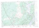
Maps showing Penrey Point, Queens, New Brunswick
Penrey Point is a Cape located in Queens, New Brunswick and has an elevation of 17 meters.
- Latitude: 45° 43' 10'' North (decimal: 45.7195647)
- Longitude: 66° 5' 39'' West (decimal: -66.0942320)
- Topography Feature Category: Cape
- Geographical Feature: Point
- Canadian Province/Territory: New Brunswick
- Elevation: 17 meters
- Location: Queens
- Atlas of Canada Locator Map: Penrey Point
- GPS Coordinate Locator Map: Penrey Point Lat/Long
Penrey Point NTS Map Sheets