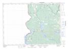
Maps showing Porten Settlement, Carleton, New Brunswick
Porten Settlement is a Unincorporated area located in Carleton, New Brunswick and has an elevation of 138 meters.
- Latitude: 45° 57' 18'' North (decimal: 45.95506)
- Longitude: 67° 31' 58'' West (decimal: -67.5327256)
- Topography Feature Category: Unincorporated area
- Geographical Feature: Dispersed Rural Community
- Canadian Province/Territory: New Brunswick
- Elevation: 138 meters
- Location: Carleton
- Atlas of Canada Locator Map: Porten Settlement
- GPS Coordinate Locator Map: Porten Settlement Lat/Long
Porten Settlement NTS Map Sheets