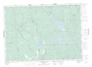
Maps showing Little Falls, Charlotte, New Brunswick
Little Falls is a Falls located in Charlotte, New Brunswick and has an elevation of 59 meters.
- Latitude: 45° 21' 45'' North (decimal: 45.3624218)
- Longitude: 66° 53' 24'' West (decimal: -66.8898866)
- Topography Feature Category: Falls
- Geographical Feature: Falls
- Canadian Province/Territory: New Brunswick
- Elevation: 59 meters
- Location: Charlotte
- Atlas of Canada Locator Map: Little Falls
- GPS Coordinate Locator Map: Little Falls Lat/Long
Little Falls NTS Map Sheets