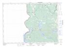
Maps showing Little Hay Brook, York, New Brunswick
Little Hay Brook is a River located in York, New Brunswick and has an elevation of 135 meters.
- Latitude: 45° 52' 2'' North (decimal: 45.8671119)
- Longitude: 67° 47' 41'' West (decimal: -67.7948564)
- Topography Feature Category: River
- Geographical Feature: Brook
- Canadian Province/Territory: New Brunswick
- Elevation: 135 meters
- Location: York
- Atlas of Canada Locator Map: Little Hay Brook
- GPS Coordinate Locator Map: Little Hay Brook Lat/Long
Little Hay Brook NTS Map Sheets