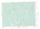
Maps showing Billy Smith Rips, Charlotte, New Brunswick
Billy Smith Rips is a Rapids located in Charlotte, New Brunswick and has an elevation of 49 meters.
- Latitude: 45° 20' 40'' North (decimal: 45.3443083)
- Longitude: 66° 51' 46'' West (decimal: -66.8626436)
- Topography Feature Category: Rapids
- Geographical Feature: Rips
- Canadian Province/Territory: New Brunswick
- Elevation: 49 meters
- Location: Charlotte
- Atlas of Canada Locator Map: Billy Smith Rips
- GPS Coordinate Locator Map: Billy Smith Rips Lat/Long
Billy Smith Rips NTS Map Sheets