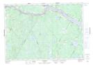
Maps showing Culliton Cove, York, New Brunswick
Culliton Cove is a Bay located in York, New Brunswick and has an elevation of 45 meters.
- Latitude: 45° 59' 56'' North (decimal: 45.9988074)
- Longitude: 67° 13' 52'' West (decimal: -67.2311934)
- Topography Feature Category: Bay
- Geographical Feature: Cove
- Canadian Province/Territory: New Brunswick
- Elevation: 45 meters
- Location: York
- Atlas of Canada Locator Map: Culliton Cove
- GPS Coordinate Locator Map: Culliton Cove Lat/Long
Culliton Cove NTS Map Sheets