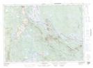
Maps showing Todds Island, York, New Brunswick
Todds Island is a Island located in York, New Brunswick and has an elevation of 119 meters.
- Latitude: 45° 35' 49'' North (decimal: 45.5968515)
- Longitude: 67° 30' 14'' West (decimal: -67.5039216)
- Topography Feature Category: Island
- Geographical Feature: Island
- Canadian Province/Territory: New Brunswick
- Elevation: 119 meters
- Location: York
- Atlas of Canada Locator Map: Todds Island
- GPS Coordinate Locator Map: Todds Island Lat/Long
Todds Island NTS Map Sheets