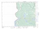
Maps showing Mill Island, York, New Brunswick
Mill Island is a Island located in York, New Brunswick and has an elevation of 216 meters.
- Latitude: 45° 49' 5'' North (decimal: 45.8179931)
- Longitude: 67° 31' 21'' West (decimal: -67.5225184)
- Topography Feature Category: Island
- Geographical Feature: Island
- Canadian Province/Territory: New Brunswick
- Elevation: 216 meters
- Location: York
- Atlas of Canada Locator Map: Mill Island
- GPS Coordinate Locator Map: Mill Island Lat/Long
Mill Island NTS Map Sheets