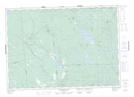
Maps showing Ragged Point, Charlotte, New Brunswick
Ragged Point is a Cape located in Charlotte, New Brunswick and has an elevation of 129 meters.
- Latitude: 45° 24' 40'' North (decimal: 45.4111753)
- Longitude: 66° 37' 41'' West (decimal: -66.6281437)
- Topography Feature Category: Cape
- Geographical Feature: Point
- Canadian Province/Territory: New Brunswick
- Elevation: 129 meters
- Location: Charlotte
- Atlas of Canada Locator Map: Ragged Point
- GPS Coordinate Locator Map: Ragged Point Lat/Long
Ragged Point NTS Map Sheets