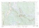
Maps showing Red Bank, York, New Brunswick
Red Bank is a Cape located in York, New Brunswick and has an elevation of 139 meters.
- Latitude: 45° 42' 13'' North (decimal: 45.7036925)
- Longitude: 67° 46' 43'' West (decimal: -67.7785643)
- Topography Feature Category: Cape
- Geographical Feature: Point
- Canadian Province/Territory: New Brunswick
- Elevation: 139 meters
- Location: York
- Atlas of Canada Locator Map: Red Bank
- GPS Coordinate Locator Map: Red Bank Lat/Long
Red Bank NTS Map Sheets