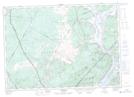
Maps showing Mistake Intervale, Kings, New Brunswick
Mistake Intervale is a Low vegetation located in Kings, New Brunswick and has an elevation of 21 meters.
- Latitude: 45° 32' 15'' North (decimal: 45.5373992)
- Longitude: 66° 2' 55'' West (decimal: -66.0486377)
- Topography Feature Category: Low vegetation
- Geographical Feature: Intervale
- Canadian Province/Territory: New Brunswick
- Elevation: 21 meters
- Location: Kings
- Atlas of Canada Locator Map: Mistake Intervale
- GPS Coordinate Locator Map: Mistake Intervale Lat/Long
Mistake Intervale NTS Map Sheets