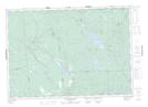
Maps showing York Dam Flowage, Charlotte, New Brunswick
York Dam Flowage is a Lake located in Charlotte, New Brunswick and has an elevation of 157 meters.
- Latitude: 45° 29' 39'' North (decimal: 45.4940953)
- Longitude: 66° 46' 43'' West (decimal: -66.7784761)
- Topography Feature Category: Lake
- Geographical Feature: Flowage
- Canadian Province/Territory: New Brunswick
- Elevation: 157 meters
- Location: Charlotte
- Atlas of Canada Locator Map: York Dam Flowage
- GPS Coordinate Locator Map: York Dam Flowage Lat/Long
York Dam Flowage NTS Map Sheets