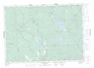
Maps showing Red Rock Ridge, Charlotte, New Brunswick
Red Rock Ridge is a Mountain located in Charlotte, New Brunswick and has an elevation of 131 meters.
- Latitude: 45° 17' 33'' North (decimal: 45.2925182)
- Longitude: 66° 43' 50'' West (decimal: -66.7304288)
- Topography Feature Category: Mountain
- Geographical Feature: Ridge
- Canadian Province/Territory: New Brunswick
- Elevation: 131 meters
- Location: Charlotte
- Atlas of Canada Locator Map: Red Rock Ridge
- GPS Coordinate Locator Map: Red Rock Ridge Lat/Long
Red Rock Ridge NTS Map Sheets