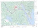
Maps showing Mitchell Brook, Charlotte, New Brunswick
Mitchell Brook is a River located in Charlotte, New Brunswick and has an elevation of 31 meters.
- Latitude: 45° 9' 41'' North (decimal: 45.1614922)
- Longitude: 67° 3' 27'' West (decimal: -67.0574225)
- Topography Feature Category: River
- Geographical Feature: Brook
- Canadian Province/Territory: New Brunswick
- Elevation: 31 meters
- Location: Charlotte
- Atlas of Canada Locator Map: Mitchell Brook
- GPS Coordinate Locator Map: Mitchell Brook Lat/Long
Mitchell Brook NTS Map Sheets