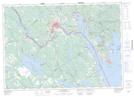
Maps showing Maxwell Crossing, Charlotte, New Brunswick
Maxwell Crossing is a Unincorporated area located in Charlotte, New Brunswick and has an elevation of 71 meters.
- Latitude: 45° 14' 44'' North (decimal: 45.245417)
- Longitude: 67° 15' 50'' West (decimal: -67.2637560)
- Topography Feature Category: Unincorporated area
- Geographical Feature: Railway Point
- Canadian Province/Territory: New Brunswick
- Elevation: 71 meters
- Location: Charlotte
- Atlas of Canada Locator Map: Maxwell Crossing
- GPS Coordinate Locator Map: Maxwell Crossing Lat/Long
Maxwell Crossing NTS Map Sheets