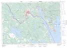
Maps showing McCulloughs Pond, Charlotte, New Brunswick
McCulloughs Pond is a Lake located in Charlotte, New Brunswick and has an elevation of 94 meters.
- Latitude: 45° 12' 44'' North (decimal: 45.2122650)
- Longitude: 67° 2' 42'' West (decimal: -67.0449712)
- Topography Feature Category: Lake
- Geographical Feature: Pond
- Canadian Province/Territory: New Brunswick
- Elevation: 94 meters
- Location: Charlotte
- Atlas of Canada Locator Map: McCulloughs Pond
- GPS Coordinate Locator Map: McCulloughs Pond Lat/Long
McCulloughs Pond NTS Map Sheets