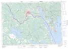
Maps showing Russell Ridge, Charlotte, New Brunswick
Russell Ridge is a Mountain located in Charlotte, New Brunswick and has an elevation of 85 meters.
- Latitude: 45° 11' 32'' North (decimal: 45.1923143)
- Longitude: 67° 4' 34'' West (decimal: -67.0760553)
- Topography Feature Category: Mountain
- Geographical Feature: Ridge
- Canadian Province/Territory: New Brunswick
- Elevation: 85 meters
- Location: Charlotte
- Atlas of Canada Locator Map: Russell Ridge
- GPS Coordinate Locator Map: Russell Ridge Lat/Long
Russell Ridge NTS Map Sheets