Maps showing Canterbury, York, New Brunswick
Canterbury is a Village located in York, New Brunswick and has an elevation of 180 meters.
- Latitude: 45° 53' 26'' North (decimal: 45.8906192)
- Longitude: 67° 27' 52'' West (decimal: -67.4644866)
- Topography Feature Category: Village
- Geographical Feature: Village
- Canadian Province/Territory: New Brunswick
- Elevation: 180 meters
- Location: York
- Atlas of Canada Locator Map: Canterbury
- GPS Coordinate Locator Map: Canterbury Lat/Long
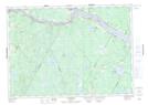
Canterbury NTS Map Sheets